![]()
![]()
![]()
![]()
![]()
![]()
|
Location The following maps show the location of Norechab and Sandfontein:
GPS co-ordinates:
Here is a Google-Earth satellite image showing the various points, as well as the Orange River. As the crow flies, it is only 27km from the Tantalite Valley airstrip to the Sandfontein Airstrip. Given the terrain however, it takes about 90 minutes to drive! 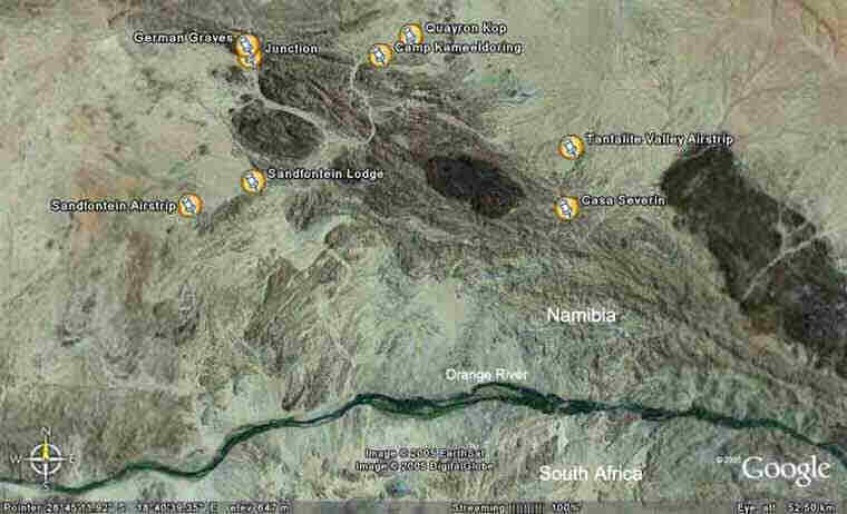
|